
Weather app for drone pilots · Android and iOS
Is it safe to fly your drone right now?
Drone Weather Forecast turns weather forecasts, wind at altitude, geomagnetic activity, GNSS satellite coverage and airspace restrictions into one clear verdict for the place and time you plan to fly.
Free to download, no ads. The optional Pro upgrade is a one-time purchase, never a subscription.
- 50,000+
- downloads
- 18,000
- active pilots
- 4.8★
- on Google Play
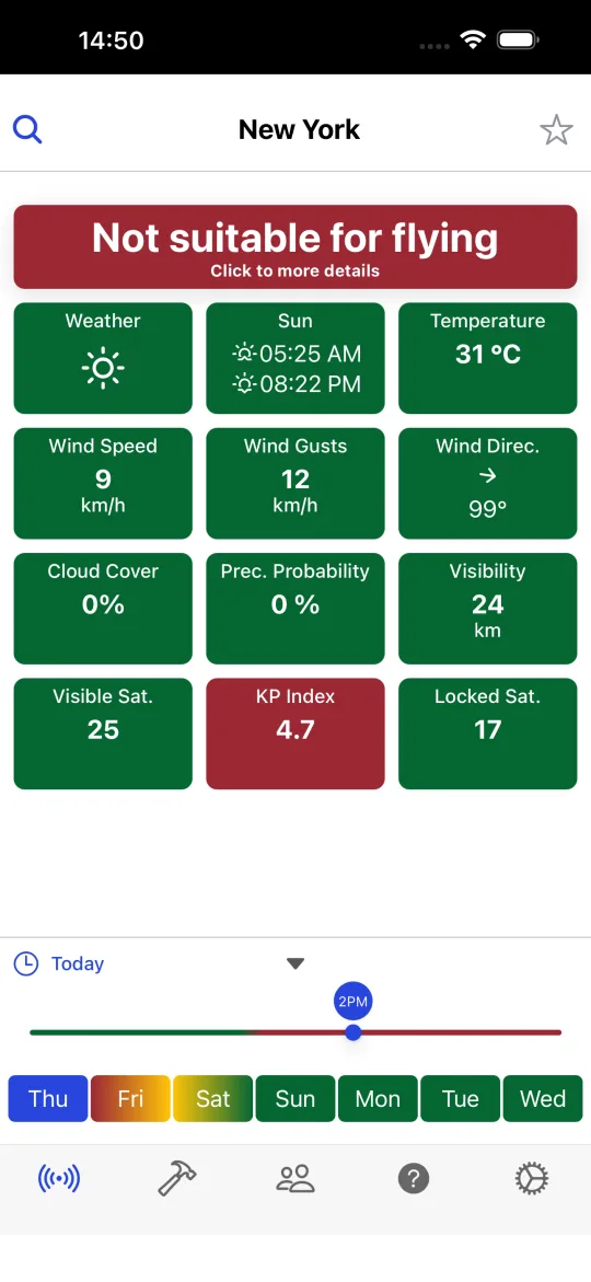
One verdict, three colours
Every card is compared with the limits of your drone. The summary at the top of the screen tells you at a glance what the data means.
All measured values are inside the limits you set for your drone.
One or more values are close to a limit, for example gusts or a rising KP index.
At least one value exceeds a limit: wind, precipitation, visibility, temperature, satellites or geomagnetic activity.
How Drone Weather Forecast works
Choose a place
Search any city in the world or use your current GPS position. Forecast times are always shown in the local time of that place, not of your phone.
Pick your drone
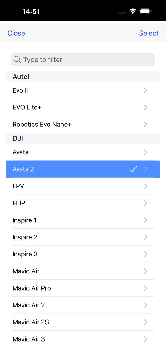
Select one of 79 presets from 9 manufacturers (DJI, Autel, Parrot, Fimi, Potensic, Holy Stone, Ryze and more) and the wind and temperature limits adjust automatically. You can also type your own thresholds.
Read the verdict
Drag the timeline through the next hours and 7 days. Each card turns green, yellow or red, and the summary tells you if the window is good for flying.
Everything a drone pilot needs before take-off, free
The free version already includes every data source a hobby or professional pilot needs for a pre-flight check.
7-day hourly forecast
Temperature, precipitation probability, cloud cover, visibility, sunrise and sunset for the exact coordinates you searched.
Wind speed, gusts and direction
Ground-level wind and gusts hour by hour, compared with the maximum wind resistance of your drone model.
KP index and geomagnetic storms
The planetary K-index from GFZ Potsdam. High values disturb GPS accuracy and compass calibration, a common cause of fly-aways.
GPS, GLONASS, Galileo and BeiDou satellites
Visible and locked satellite counts computed from CelesTrak orbital data for your position, with a configurable elevation mask.
No-fly zone map
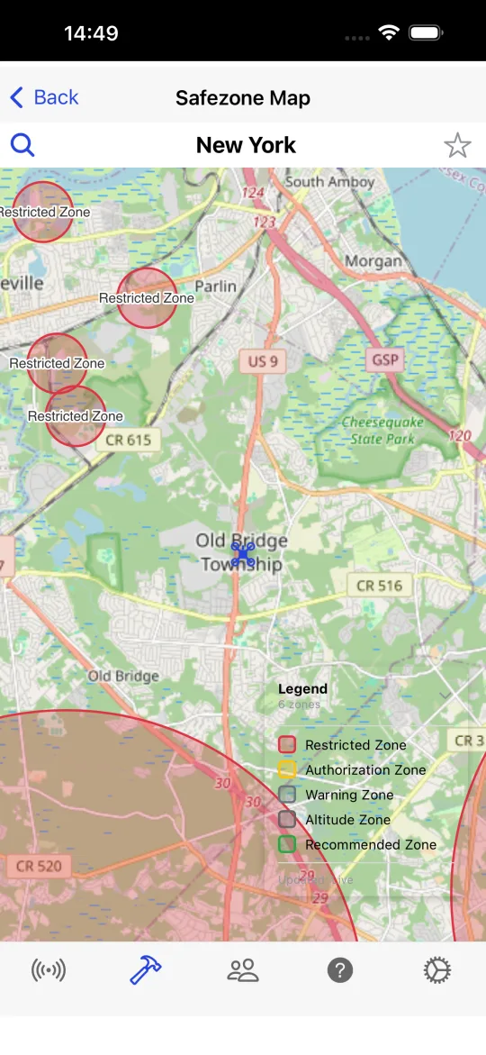
DJI GEO zones (restricted, authorization, warning, altitude and recommended zones) drawn over OpenStreetMap. The zone data is stored on your device, so the map works without a connection.
Pre-flight checklists and flight history
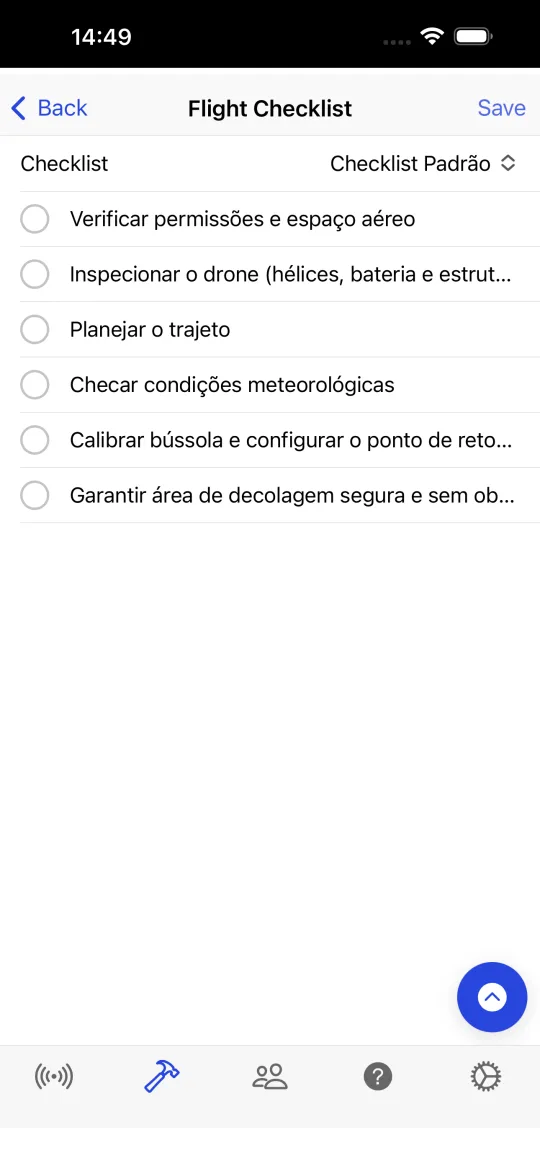
Create your own checklists, tick them off before every flight and keep a history of completed checks.
Drone presets
Limits for 79 models from DJI, Autel, Parrot, Fimi, Potensic, Holy Stone, Ryze, LYZRC and SKYROVER, updated remotely without an app update.
Pilot community
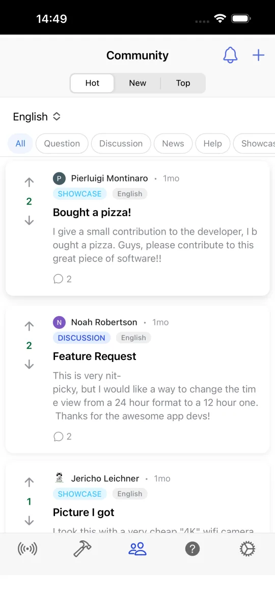
A moderated forum to ask questions, share flying spots and post aerial photography. Sign in with Google or Apple.
Your units, your limits
km/h, m/s, mph or knots; °C or °F; metres or feet; 12 or 24-hour clock. Every threshold can be customised.
15 languages
English, Português, Español, Français, Deutsch, Italiano, Nederlands, Polski, Bahasa Indonesia, Русский, 日本語, Türkçe, Ελληνικά, 简体中文, 繁體中文, हिन्दी.
Drone Weather Forecast Pro: pay once, keep it forever
Pro unlocks the advanced tools. It is a single in-app purchase tied to your Google or Apple account, with no subscription and no recurring fee.
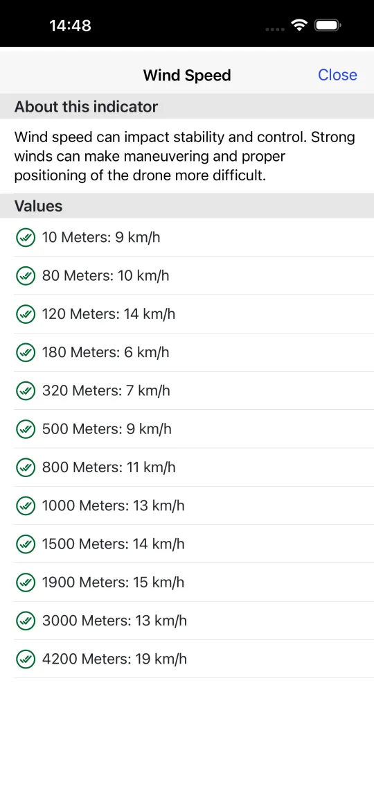
- Wind profile by altitude. Wind and estimated gusts at 10, 80, 120, 180, 320, 500, 800, 1,000, 1,500, 1,900, 3,000 and 4,200 metres, so you know what your drone will meet when it climbs.
- Hourly forecast table. Every indicator for every hour of the coming days in one scrollable table.
- Wind compass. A compass that points into the wind, shows magnetic and true heading and warns about magnetic interference before you calibrate.
- Premium data sources. Switch the forecast provider to Apple WeatherKit or WeatherAPI, merged with Open-Meteo altitude winds.
- Favourite cities. Save the places you fly most and jump to them in one tap.
- Post in the community. Create posts and comments in the pilot forum. Reading is free for everyone.
One-time purchase. US$ 4.99 on the App Store; Google Play shows the price in your local currency.
Same store account, all your devices. Restore purchases is available in the app.
A look inside the app
Where the data comes from
Drone Weather Forecast does not invent numbers. Every value on screen is traceable to a public or licensed provider, and missing data is shown as missing, never as zero.
- Open-Meteo — Default 7-day forecast, wind at altitude, geocoding and time-zone lookup.
- Apple WeatherKit — Alternative forecast provider for Pro users, requested through a server-side proxy.
- WeatherAPI — Alternative 3-day forecast for Pro users, merged with Open-Meteo for the remaining days.
- GFZ Potsdam — Planetary KP index (geomagnetic activity).
- CelesTrak — Orbital elements (TLE) for the GPS, GLONASS, Galileo and BeiDou constellations.
- DJI Fly Safe geozones and OpenStreetMap — No-fly zone polygons and base map. Nominatim is used for reverse geocoding.
The no-fly zone map is a visual reference. Before every flight, check the official airspace rules of your country (for example FAA B4UFLY in the United States, DECEA SARPAS in Brazil or your national EASA authority in Europe).
Frequently asked questions
Is Drone Weather Forecast free?
Yes. The forecast, wind, KP index, satellite count, no-fly zone map, checklists and the community are free, without ads. Pro is an optional one-time purchase that unlocks the wind profile by altitude, the hourly table, the wind compass, premium data sources, favourites and posting rights in the forum.
What do “Safe to fly”, “Fly with caution” and “Not suitable for flying” mean?
The app compares every available value for the selected place and hour (wind, gusts, precipitation, visibility, temperature, cloud cover, KP index and satellites) with the limits of your drone. When all values are within limits the verdict is “Safe to fly”; when some values are close to a limit it is “Fly with caution”; when at least one value exceeds a limit it is “Not suitable for flying”.
Which drones are supported?
There are 79 presets from DJI, Autel, Parrot, Fimi, Potensic, Holy Stone, Ryze, LYZRC and SKYROVER, and the list is updated remotely. If your model is missing, choose “Customized” and type the wind and temperature limits from your manual.
Why is the forecast sometimes different from what I see outside?
A forecast is an estimate produced by numerical weather models. Conditions can change quickly, especially wind gusts near buildings or terrain. Use the app as a planning guide and always confirm the local conditions before take-off.
What is the KP index and why does it matter for drones?
The KP index measures the geomagnetic activity of the Earth on a scale from 0 to 9. High values (geomagnetic storms) degrade GPS accuracy and compass readings, which can cause position drift and fly-aways. Drone Weather Forecast shows the current and forecast KP and lets you set a maximum value.
How does the satellite count work?
The app downloads the orbital elements of the GPS, GLONASS, Galileo and BeiDou constellations and computes which satellites are above the horizon at your position and time, using the elevation mask you configure (15° by default). More visible satellites mean a more stable position hold.
Does the app work offline?
The no-fly zone data is stored on the device, so the map works without a connection. Weather, KP and satellite data need an internet connection to be refreshed.
How is Pro sold and can I use it on more than one device?
Pro is a non-consumable in-app purchase processed by Google Play or the App Store. It is tied to your store account and can be restored on any device signed in with the same account through “Restore purchases”.
Is there a web version?
Drone Weather Forecast is distributed through Google Play and the App Store for Android phones and tablets, iPhone, iPad and Apple silicon Macs. There is no public web version.
How do I delete my account?
Open Settings in the app and tap “Delete Account”, or follow the instructions on the account deletion page. Your profile is erased and your forum posts are anonymised.
Download Drone Weather Forecast
Free on Google Play and the App Store. Check the wind, the sky and the airspace before every flight.